Victorian Planning Authority, in consultation with Council, has developed The Lilydale Quarry Comprehensive Development Plan (the Plan) guides the sustainable staged development of 143 hectares of the former quarry site over the next 20 years.
The Lilydale Quarry site is located on the southern edge of the Lilydale Activity Centre and interfaces educational, industrial, open space and residential areas. The land is bounded by Mooroolbark Road to the west, Maroondah Highway and Melba Avenue to the north, Hull Road to the south and residential neighbourhoods to the east and south east.
The Plan identifies the location of approximately 3,000 future homes and the infrastructure needed to support the growing community such as roads and community facilities. It also outlines commercial land for employment and retail. This will provide certainty to the Lilydale community about what changes to expect on the former quarry site over the next 20 years.
The future site will build on Lilydale’s local character and celebrate its heritage from the Wurundjeri Traditional Owners through to its industrial use as a former limestone quarry.
The Vision for Lilydale Quarry
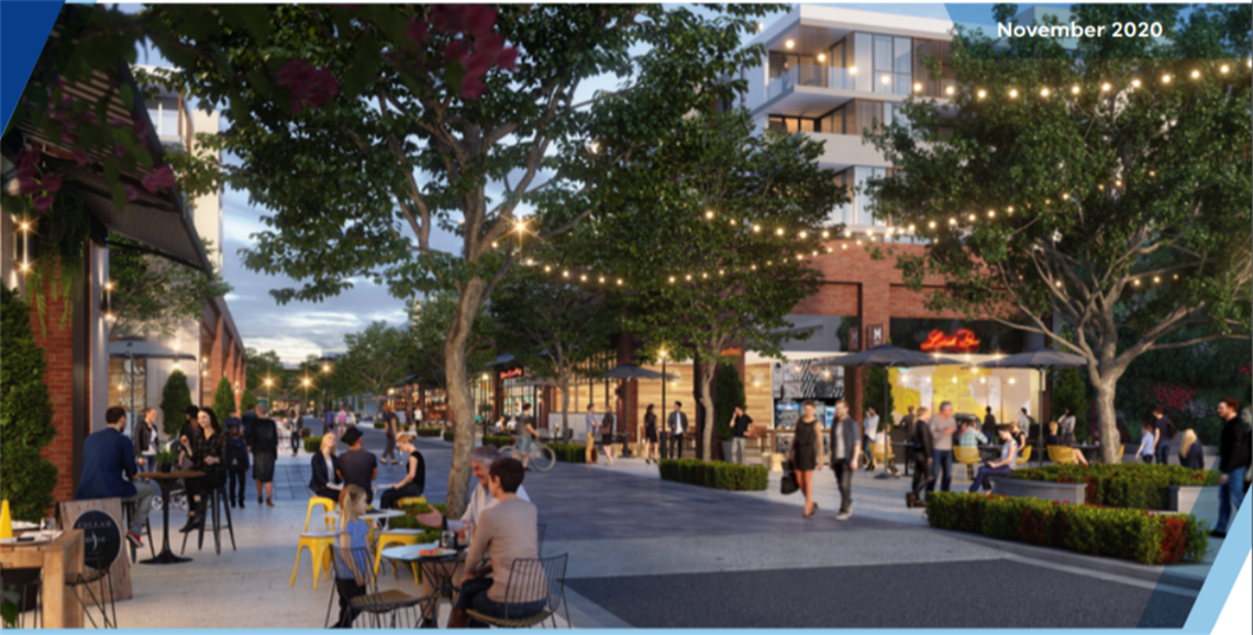
The former Lilydale Quarry will become a major new urban renewal precinct with a master plan that prioritises liveability and sustainability. A true 20-minute neighbourhood, it will provide housing diversity, recreation opportunities, services and transport modes that support the future community and integrate with surrounding neighbourhoods. Designed to achieve high levels of walkability, the development will provide social interaction and encourage healthy, active lifestyles.
The Plan for Lilydale Quarry
The Victorian Planning Authority (VPA), Yarra Ranges Council and government agencies worked closely with the land owners to help them prepare the plan for the site over the past three years. The Plan is also informed by technical background documents such as a biodiversity assessment, traffic assessment and drainage catchment assessment, among many others.
New mixed-use urban environment
Creating a vibrant urban neighbourhood by providing a variety of home types and densities and a complementary mix of active and social uses to support a modern, connected community.
Transit oriented development
Establishing a vibrant focus for community life around a potential station (no commitment made) by creating connections through a safe, convenient and attractive active transport network.
A safe and walkable neighbourhood
Supporting active and healthy lifestyles through a mixed-use neighbourhood that brings the daily convenience, social, transport and education needs of the community within a 20-minute walkable catchment.
Preserve the memory
Celebrating the unique history of Lilydale Quarry to create a distinct local character and place identity.
Diverse open spaces
Designing diversity and variety into public spaces to cater for different users and activities, both active and passive, urban and landscape.
Community heart
Providing a range of spaces and facilities to meet the needs of the community, supporting social interaction, resilience and liveability.
Sustainable change
Delivering productivity and sustainability outcomes in all aspects of the new urban form through connected, diverse and enduring communities.
Amendment C193 to the Yarra Ranges Planning Scheme
The VPA has prepared draft Amendment C193yran to the Yarra Ranges Planning Scheme for a Comprehensive Development Plan to rezone the land to a Comprehensive Development Zone to enable future decisions about the development of the site. The Plan identifies four precincts for housing and mixed use development:
Precinct 1 – Western Neighbourhood
Mix of detached and medium density housing with a commercial strip fronting Maroondah Highway on the northern edge
Precinct 2 – Heritage
Heritage Victoria listed elements of the former limestone processing area; mixed use including open space, creative industries and tourism
Precinct 3 – Eastern Neighbourhood
Mix of detached and medium density housing
Precinct 4 – Urban Core (central area of the development site)
A potential station (no commitment made) surrounded by higher density housing, local retail, commercial and community uses including a future school and council facilities.
Find out more and have your say
To find out more, or to provide feedback on the plan please visit https://engage.vic.gov.au/lilydale-quarry